Trekking Maps
₹850.00 inc. GST
Leomann Map Sheets:
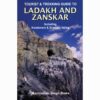
- Sheet No. 1: JAMMU & KASHMIR: Srinagar, Kolohoi Glacier & Kishtwar area.
- Sheet No. 2: JAMMU & KASHMIR: Kargil, Zanskar & Nun- Kun area.
- Sheet No. 3: JAMMU & KASHMIR: Nubra Valley, Leh, Markha, & Zanskar area.
- Sheet No. 4: HIMACHAL PRADESH: Chamba, Dhauladhar Passes, Pangi Valley, and Western Lahul.
- Sheet No. 5: HIMACHAL PRADESH: Kullu Valley, Parbati Valley & Central Lahaul.
- Sheet No. 6: HIMACHAL PRADESH: Kalpa – Kinnaur, Spiti & Shimla area.
- Sheet No. 7: UTTARANCHAL (GARHWAL): Gangotri, Har Ki Dun & Mussourie area
- Sheet No. 8: UTTARANCHAL (KUMAON): Pindari Glacier, Badrinath & Nanda Devi area
- Sheet No. 9: JAMMU & KASHMIR / CHINA: Rupshu, Tso Moriri, Pangong Tso
Description
Leomann Maps
The Himalaya has attracted geologists, geographers, and lovers of nature. They have a strange fascination for artists, poets, photographers, and mystics. They are a paradise for trekkers and mountaineers and are the cradle of thousands of rivers, streams, and glaciers.
The Himalaya extends over 2500 km in east-west and between 250 km and 425 km in a north-south direction. The most extraordinary thing about the Himalaya is the way they have been formed in three parallel ranges, known as; The Great Himalaya, the Lesser or Central Himalaya, and the Outer or Siwalik Himalaya. Commencing at Nanga Parbat in the north-west, these ranges pass through Pakistan, Jammu & Kashmir, Himachal Pradesh, Garhwal, Kumaon, Nepal, Sikkim, Bhutan, and Arunachal Prades
You may also like…
-
- Sale! Select options This product has multiple variants. The options may be chosen on the product page
- BAGS, Camera Bag
Camera Bags
- ₹800.00 – ₹1,050.00 inc. GST
-
- Select options This product has multiple variants. The options may be chosen on the product page
- Accessory Kit, CLOTHING, Trek Wear
Multi-Pocket Jacket
- ₹1,600.00 inc. GST
-
- Select options This product has multiple variants. The options may be chosen on the product page
- Other Accessories, ROCK & ICE GEAR
Hiking Pole
- ₹1,100.00 inc. GST


